After walking from St Ives to Falmouth along England’s South West Coast Path (in Cornwall) last October, I’ve written some posts about each of the stages — mainly as a way to share photos and remember some of the detail.
This is the third post, detailing the final four days of my walking itinerary. The first two posts cover the first week (St Ives to Penzance) then the next two days of walking (Marazion to Mullion).
Mullion Cove to Cadgwith (~11 miles)
This was one of my favourite legs of my entire coast path walk, despite the fact it was also the longest at about 11 miles.
I think the favourite points were partly because of the beautiful scenery as I went around the Lizard — England’s most southern mainland point. Partly because it was very pleasant and easy walking — much of it along grassy cliff tops. And partly because I took some ibuprofen, which made a huge difference to all my aches and pains.
I felt awesome for pretty much the whole day.
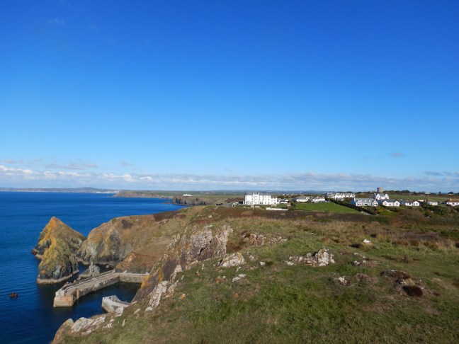
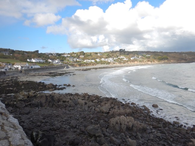
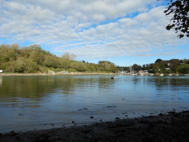
The first mile of the day involved walking down from the town of Mullion to the adorable quay at Mullion Cove. I took a few minutes to look around, then headed up onto the clifftops — Higher Predannack then Lower Predannack Cliff. (The image above shows the view back to Porthleven.)
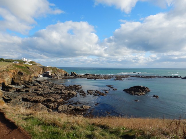
From here it was gorgeous walking south through grassy fields towards picturesque Kynance Cove (which was teeming with day trippers) and its green serpentine rock.

Unfortunately for me, the Kynance Cove cafe wasn’t open, so I kept going towards Lizard Point, another couple of miles away. Luckily there were a couple of cafes open at the bottom of England, and I enjoyed a delicious toastie with coffee at the Polpeor Cafe.
By this stage I’d walked six miles along the path (seven in total) and still had four miles to go! The afternoon was getting on, so I couldn’t linger too long at the cafe to watch the seals before heading to Cadgwith.
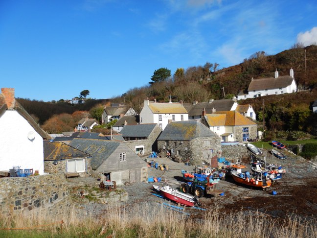
This next section of the path wasn’t as spectacular, being more heavily vegetated, and I was (needless to say) extremely happy to arrive at my destination, the Cadgwith Cove Inn. Cadgwith is a gorgeous little village, with plenty of thatched fishermen’s cottages, nets and boats.
Cadgwith to Porthhallow
Ibuprofen or no, I’d previously decided not to walk the 12 miles from Cadgwith to Porthhallow. Too far. After three days walking (two of them more than 10 miles), I was ready for a rest. However, I still needed to get to the village of Porthallow, where my luggage was being deposited and my room was booked.
It ended up being quite a fun and relaxed day. First I whiled away some time with my kindle in the very pretty village of Cadgwith. Then, a friendly holidaymaker I met the previous evening gave me a lift to the town of Coverack (eliminating seven miles walking).
Coverack is renowned for displaying a geological phenomenon on its beach; that is, it shows the exposed “moho”, which is the boundary between the earth’s mantle and crust. The Serpentine rock to the south (foreground below) would have once been part of the mantle, while the gabbro rock to the north would have once formed part of the crust. I wandered along the beach trying to identify the transition zone. Ha.
To avoid walking the next five-mile section of the coast path (which was diverted inland due to floods last year and quarries), I caught a local bus from Coverack to the nearby town of St Keverne. I chose St Keverne because the bus went there and it was only two miles from Porthallow via a well-marked pubic footpath (which also had geocaches along it). So 12 miles of walking became two miles, with extra time to grab a few geocaches. Win-Win!
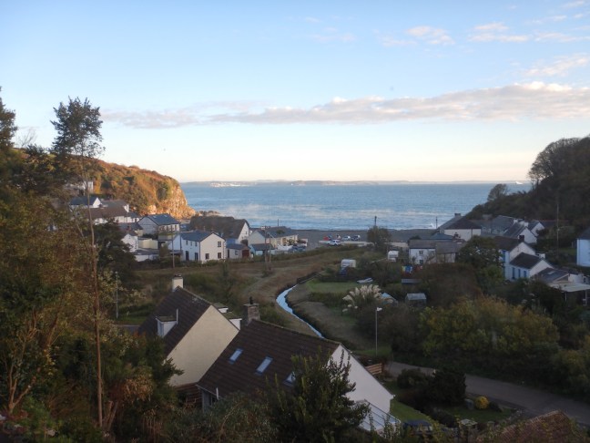
Porthallow was a sleepy little town with not much going on, although it is the official half-way point of the entire coast path. I had a great view from my bedroom window — I think that’s Falmouth in the distance.
Porthallow to Mawnan Smith (~7 miles)
This particular leg was something of an adventure, as it involved two river crossings and, although I was hopeful, I was by no means certain the ferries would still be running on 30 October. They were, as it turned out, but had I arrived two days later I would have been out of luck.
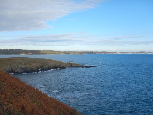
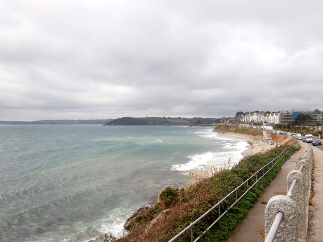
It was easy walking for most of the day, the path taking me north from Porthallow to Nare Point, which gave good view of my ultimate destination, Falmouth!
From Nare Point, the path turns west into Gillan Harbour (Gillan Creek) and Helford Passage.
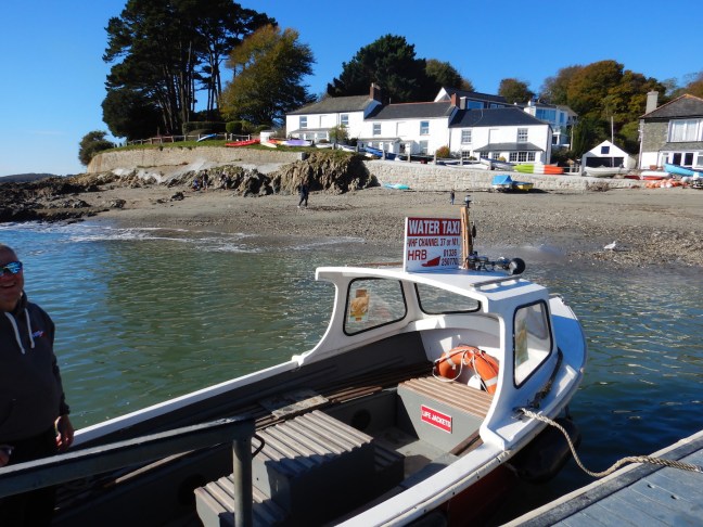
Crossing Gillan Creek was the first challenge. The advertised options were wade/ford (if low tide), stepping stones (if low tide) or maybe, if you’re lucky, an on-demand ferry…
It was not low tide. Fingers crossed, I signalled the ferry. Woo hoo! It cost me five pounds, but I didn’t care. (Otherwise I would have had an extra two miles of walking and by this stage of the walk I was cutting corners wherever possible.)
After crossing Gillan Creek, the path ventured partway around Dennis Head, before doubling back west towards Helford, where there was a more substantial river crossing. It was the second last day for the season, but Helford Ferry was still in operation and I was very relieved. Even if I was surprised it was such a small boat! (The alternative was an expensive taxi ride the long way around.)
I sat down for lunch at the Ferryboat Inn, enjoying the autumn sunshine. Then I walked for another hour or so — first along the coast path a little way, then inland to the town of Mawnan Smith.
Mawnan Smith to Falmouth
For my final day of walking, I elected not to rejoin the coast path where I left it (south at Porth Saxon), but instead headed east from Mawnan Smith to rejoin it at Bream Cove, thereby cutting out a short section. From there it was not long before I passed by Maenporth beach, followed by the outer reaches of Falmouth, such as Swanpool and Gyllyngvase Beach.
Needless to say, I did not walk the long way around Pendennis Point, but instead hightailed it across the narrow peninsula to find the shops and restaurants of Falmouth. As a result, my final day of coast path walking was pretty short. Not that I was complaining.
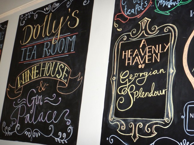
I wandered along the streets of Falmouth for a bit, checking out the harbour, before I found Dolly’s! Hands down, my favourite place in Falmouth. I wished I was there with friends so I could do a proper gin tasting. (It’s really not the same on your own.)
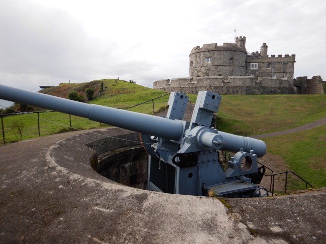
The following morning I explored Pendennis Castle. The history of this Tudor gun tower, built by Henry VIII, and its subsequent role in the defence of England’s southern shores — as recently as World War II — was very interesting. I spent quite some time there, looking at all the guns of different eras.
My final afternoon in Cornwall was spent relaxing, wandering the streets of Falmouth, before heading to Dolly’s again for an early dinner. Falmouth is a lovely town. I could definitely live there quite happily!
This marked the end of my South West Coast Path walking expedition. From Falmouth I caught the (very expensive) train up to London to visit a series of friends… and after that I went to Morocco.
But that’s another story entirely.

Looks beautiful Ellen. What a great hike!
LikeLiked by 1 person
It was truly awesome. 🙂
LikeLiked by 1 person