Back in October I spent a couple of weeks hiking the UK’s South West Coast Path in Cornwall — from St Ives to Falmouth. The complete distance is 102 miles (according to the South West Coast Path website).
I wrote about the first stage of my journey while taking a couple of rest days in Penzance. (See my previous post: South West Coast Path: St Ives to Penzance.) Even though I was walking at the so-called “relaxed” pace, I really needed those rest days!
I started writing up the second stage of my trek a few weeks ago while still traveling, but phone blogging just wasn’t doing it for me anymore. So I decided to wait until I was home to finish it — apologies if you’ve been wondering where I got to!
Since the first post ended up so big and took ages to put together, I’m going to break down the second stage into two or possibly three posts. This post covers the next two days of walking: Marazion to Porthleven (11 miles), then Porthleven to Mullion Cove/Mullion (6-7 miles).
Penzance
I didn’t do much during my rest days in Penzance. When I scheduled them, I half thought I might have taken the opportunity to do some work (me having aspirations to be a digital nomad), but in fact I was tired after six days of activity, and thankful I hadn’t committed to any work.
I walked around a little, picked up a few geocaches, and sat in cafes. It was good to rest my body — my feet especially. I didn’t get back to Mousehole or undertake any other excursions I had contemplated. Penzance is a nice town and a major centre for the region. It has good facilities and proved a good spot to chill out for a couple of days.
Marazion to Porthleven (11 miles)
I had always planned to start walking from Marazion, cutting off the 3.5 miles along the foreshore from Penzance. It was a straightforward bus ride, but then I stopped for coffee in Marazion (as you do), so I left the town later than intended.
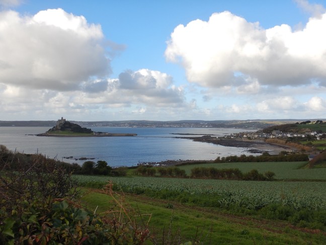
The walking out of Marazion was pretty easy, through market gardens, with views back to St Michael’s Mount. I didn’t stop to visit the Mount, having walked across the causeway last time I was here.
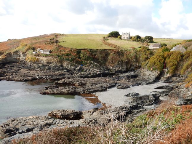
With 11 miles to walk — my longest day to-date — I was a little apprehensive as to how I would manage and kept an eye on the time. The first milestone was the tiny village of Perran Sands, where there was fortunately a toilet, then around Cudden Point to ‘Prussia Cove’, renowned as the former headquarters of the infamous smuggler John Carter, The King of Prussia. Prussia Cove is actually made up of several small coves, including the pretty and quaint Bessy’s Cove.
After 6-1/4 miles, I reached the town of Praa Sands in good spirits, with good energy, in time for a late lunch of soup and bread at a restaurant/bar called the Sandbar — which was right on the long, white beach and seemed very popular.
Although I had originally intended to take packed lunches each day, in the end I mostly relied on cafes etc when they were available. I think a big reason for this was the chance to sit down somewhere warm and comfortable for a bit. (Get off my feet!) The weather was cooler in the second week, so the chance for a hot meal and a coffee was usually too good to pass up. Soup became quite a common lunch for me, since breakfast was always so big and it was a healthy option served with bread instead of fries.
On leaving Praa Sands, I then had another 4.5 miles to Porthleven. As suggested by the guide book, I elected to walk along the very long Praa Sands beach instead of the path… which proved a little annoying as it was literally covered with rivulets of water running into the sea (which I had to jump over).
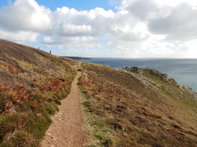
The path got more strenuous for the last few miles. My destination, Porthleven, was visible for a very long time, but it seemed to take a very long time to reach it. This included some infuriating sections of path that traversed three sides of a square around the cliff tops… twice! (Honestly!)
I was very tired when I finally made it into Porthleven — after my longest day yet. I went straight to my B&B (Wellmore End), where the welcome was hearty and warm — and included hot chocolate sachets, which went down VERY well.
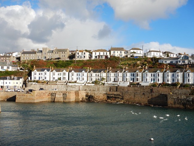
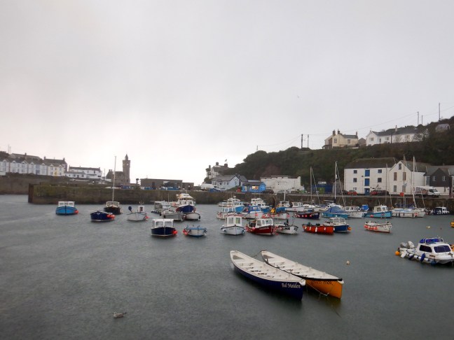
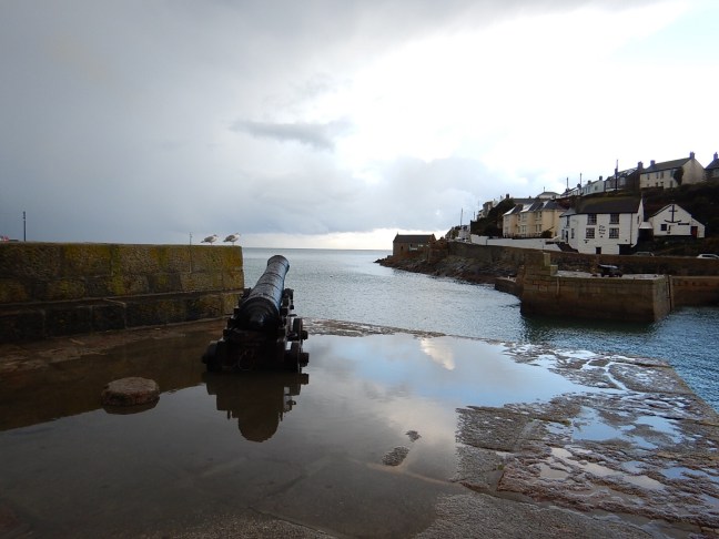
Porthleven is a gorgeous town, clustered around an extensive constructed cove (typically Cornish, apparently). Unfortunately, I didn’t have time (or energy) to look around. I did, however, drag myself out for dinner to a local restaurant and ate something other than pub food.
Porthleven to Mullion (6-7 miles)
After the first week of gorgeous sunshine, the weather definitely decided to turn colder in this last week of October. I awoke in Porthleven to the coldest, dreariest morning yet. This was the first rain I’d witnessed in Cornwall. There was also hail.
Unfortunately I didn’t get much chance to look around Porthleven in these conditions. I had been planning to wander around a bit and grab a few geocaches before leaving — particularly since I had a much shorter distance to walk. It was very disappointing, particularly as the rain soon eased (if only I’d waited a bit). Oh well.
Although the morning was mostly cloudy, the sun showed its face here and there. I was a bit stiff and sore after the previous long day, and my energy levels seemed down — it felt as though I was walking slowly. This was frustrating, considering how good I’d felt the previous day.
The first landmark was the Loe, a freshwater lagoon renowned for diverse bird life. It is also supposedly the lake into which Sir Bedivere cast Excalibur, the sword of the dying King Arthur. Since my grandfather used to tell us the story of “the lady in the lake”, whose hand came out of the water to catch the sword, this was of particular interest to me.
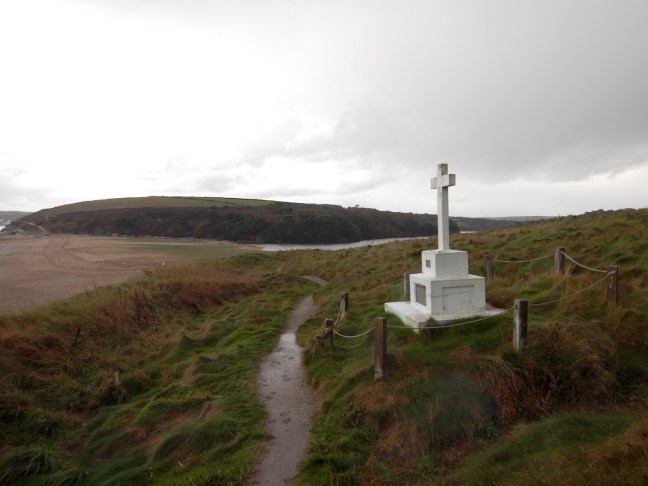
The Loe is separated from the ocean by a strip of sand/shingle called Loe Bar. The Coast Path forges across this bank and passes a memorial to the 1807 Grylls’ Act, which allowed bodies washed up by the sea to be buried in the nearest consecrated ground without being proven Christian.
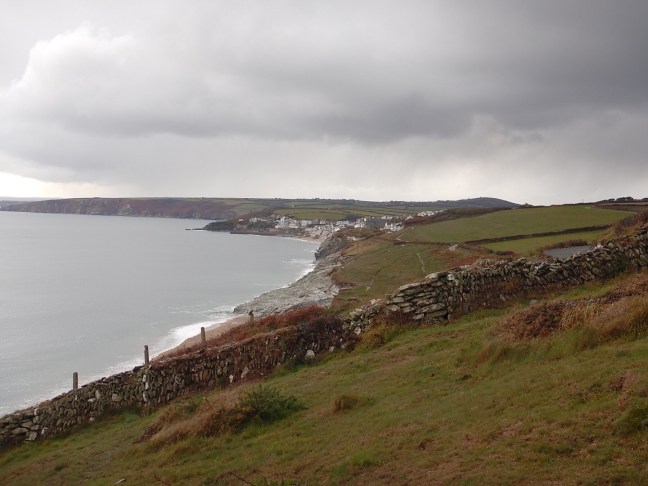
Then came Gunwalloe fishing cove, where a path diversion due to a cliff fall saw me take the long way around. And then another case of walking three sides of the square around Halzephron Cliff… It was tempting to follow the more direct road instead, but I stuck to the path and was glad in the end since it was pretty.
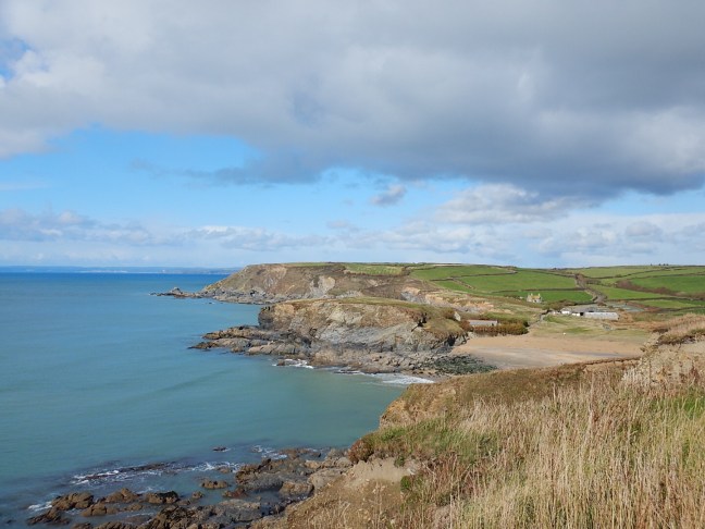
After a while I reached Poldhu Cove, where there is an all-year beach cafe. Although I was always intending to stop for coffee and lunch, mainly I just wanted to sit down and get warm, because the day was really cold and my feet/ankles/knees were aching.
From Poldhu Cove, I had a number of options: 1) Continue walking to Mullion Cove (~1 mile) then walk inland to my B&B in the town of Mullion (~1 mile); 2) Skip the last section of coast path and walk directly to Mullion along the road (~1mile); 3) Catch the bus from Poldhu Cove to Mullion (and not walk any further).
I ended up hanging out in the drafty cafe for an hour or so and catching the bus. Somehow I managed to get deposited right outside my B&B, but I was way too early for the check-in window, so I holed up with my kindle and hot chocolate in a diner across the road.
The Old Vicarage B&B was a lovely old home, and I had a large room and bathroom with a bath. Thankfully, it was only a short walk to the nearest pub for dinner. Because of the aches and pains in my ankles and knees, I decided to try taking ibuprofen for the next day.
That’s it for now… Only four more days until Falmouth.

One thought on “South West Coast Path: Marazion to Mullion”