 So, I went hiking a couple of weeks ago. (Yep.) And, despite apprehension about my general fitness, I survived four days of schlepping around the Tasman Peninsula with only a few blisters and a mild case of sunburn.
(I did wonder a few times — muscles burning, lungs wheezing — what the hell I was doing, but that’s enough said about that.)
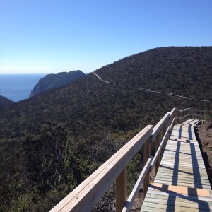
The Three Capes Track in Tasmania is one of those new hiking ‘experiences’, where you pay some money for the privilege of using a well-constructed track and staying in beautiful new eco huts with kitchen facilities, dorm beds, and other, er, facilities. (Let’s just say, this was a far cry from toileting Mongolian style… They might have been long drop toilets, but there were stalls with doors and everything.)
It had been a while since I’d gone hiking. The last time I carried a full pack was January 1999 for Tasmania’s Overland Track. Then in around 2005 I spent eight days trekking in Nepal — but that time I had porters to carry my gear (thank the stars).
For the Three Capes Track we didn’t need to carry tents or stoves, but we did need to carry other gear and food — and we ate (and drank) extremely well — so it was kind of a halfway deal. I just gritted my teeth and told myself it was yet more research and, as I went up and down more steps than I cared to count, realised that Zillah (my kick-ass Dungeons and Dragons character) I am most definitely not…
Three Capes Track – Day 1
The first day is just 4km, starting from Denmans Cove near the historic Port Arthur site. We took the later scenic boat ride (sea eagles perched in the trees!) from Port Arthur, to arrive at the cove at around 3pm. We then took our time and climbed up through coastal forests to arrive at Surveyors Hut in time for a pre-dinner cup of tea.
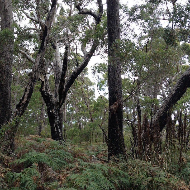
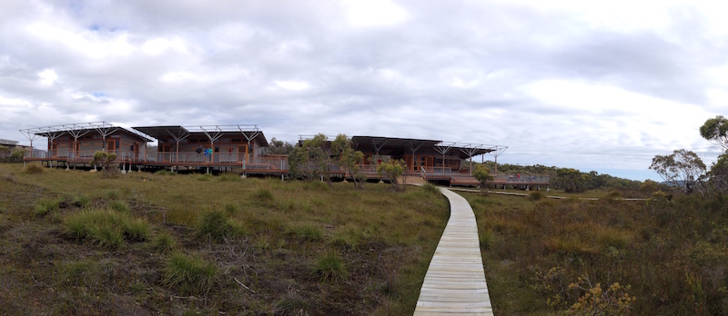
The walk is somewhat up and down (and up) to the top of the cliff, but not difficult. It was a good length just to get me into the mood of carrying my pack. And the first sight of Surveyors Hut, as we came around a bend out of the bush, took my breath away. That thing is so huge! It’s beautifully designed, with broad decks and lots of space — not to mention a gorgeous view.
That night we dined in impressive style, thanks to one of my hiking companions: chicken curry with rice, steamed greens and poppadoms. And red wine (decanted into a bladder for carrying). And brownies for dessert. As I said, we ate well!
Day 2
We began the second day in leisurely fashion, taking our breakfast (instant oats with dried blueberries and sweetened condensed milk) and coffee (one of my companions carried a stove-top espresso maker!) with easy conversation. It was so nice to hang out with fellow hikers. We headed off walking at about 10am.
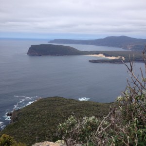
The second day’s walk is 11km, undulating along clifftops towards Cape Pillar, including up and over Arthur’s Peak and Crescent Mountain. The views are staggering — back towards Cape Raoul and Crescent Bay, where dune-surfing takes place, and to Cape Pillar in the other direction.
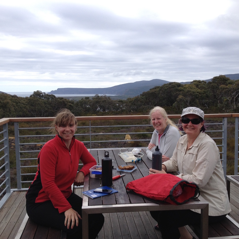
We again took our time, stopping at each of the marked “Encounters” to read from the guide book about some aspect of history, or geology, or vegetation, or wildlife etc of the place we had stopped at. These encounters are one of the great aspects of the hike — and they are the thing that makes it an “experience”, rather than a simple hike. They are marked most often by some form of creatively designed bench seat, offering a good excuse to rest for a few moments.
More than that, though, the encounters really made us stop and look and think about where we were. They made me notice the changing vegetation and look out for things I might not have noticed otherwise. The little book containing all the information is a really fabulous initiative.
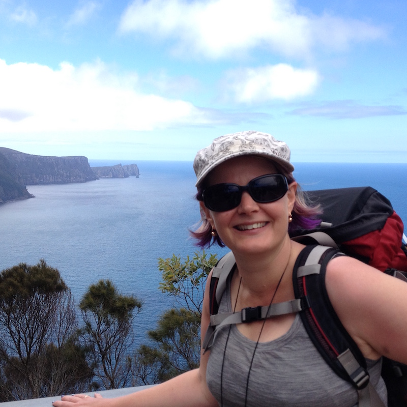
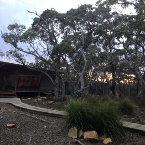
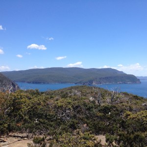
We arrived at Munro Hut late afternoon, and spent the hours leading up to dinner relaxing on the deck and admiring the view (see photo with me at the top). More wine that night, and some whisky I’d been carrying. Plus a Thai vegetable curry with tofu. And Lindor balls. Yum.
Day 3
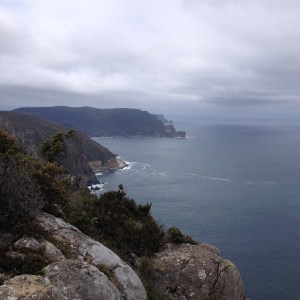
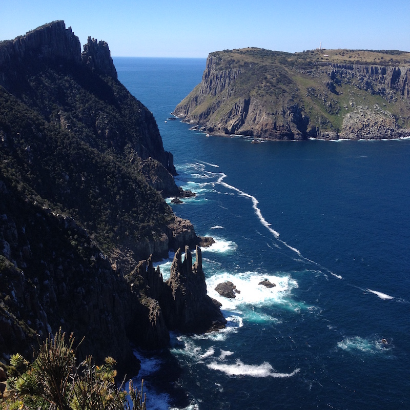
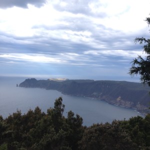
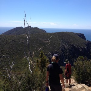
Lots of good things about day 3 (17km) — including the fact that most of it involved leaving our packs at Munro Hut and taking day packs out to the tip of Cape Pillar, where there is a rocky feature known as The Blade.
You can see from the above photos that we had glorious weather — in fact, it was hot hot hot. Again, it’s not a difficult walk, although there is plenty of up and down (and steps). We clambered up to the tip of the Blade, which overlooks Tasman Island, just to say we’d done it, but the views are better from elsewhere. There’s a lighthouse on Tasman Island and a weather station. And seals frolic in the rockpools at its feet.
After the return trip from Cape Pillar, it took less than an hour carrying our packs to reach Retakunna Hut, which sprawls and nestles in a bushland setting. It’s serene and beautiful there. Finally it was time to eat the dinner food in my pack, and I was glad to get rid of the potato, carrots, snow peas and half a dozen fresh eggs I’d been carrying! This was combined with tuna and couscous and other bits and pieces to form a hiking version of nicoise salad.
Day 4
We rose early on Day 4 (dawn! I swear it’s true!), because although only 14km it’s actually the longest day from a time point of view and walkers need to be finished by a certain time to catch a bus back to Port Arthur at the end. We were on our way by 8am and reached the top of Mount Fortescue by 9am, once the morning drizzle cleared and before the clouds had burnt off.
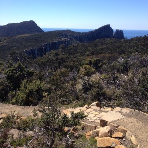
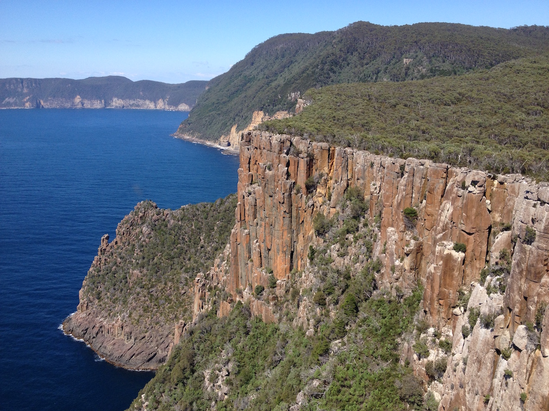
Once the clouds did burn off, the day turned scorching hot. Day 4 is only 14km, but I admit to being generally fatigued by the final day (unfit, remember?) and this was the hardest day for me without doubt. It’s a gorgeous walk, though. The first climb of Mount Fortescue and its descent is through beautiful rainforest. Then we came out onto the clifftops on the other side, where the views are again stupendous. The geology of this part of the world is certainly striking.
Towards the end of the walk, we all downed packs for a side trip to the tip of Cape Hauy. This was not really too far, but it was hot, I was tired, and there were steps. Steps up and steps down. More steps.
Steps.
And hot.
This was definitely the hardest section of the entire walk for me, most likely a combination of the heat and fatigue. But it was all over in a couple of hours, and then it was time for the final descent to Fortescue Bay, where the bus was picking us up at 4pm. We arrived by about 3pm, which gave us time to relax before getting transported back to Port Arthur.
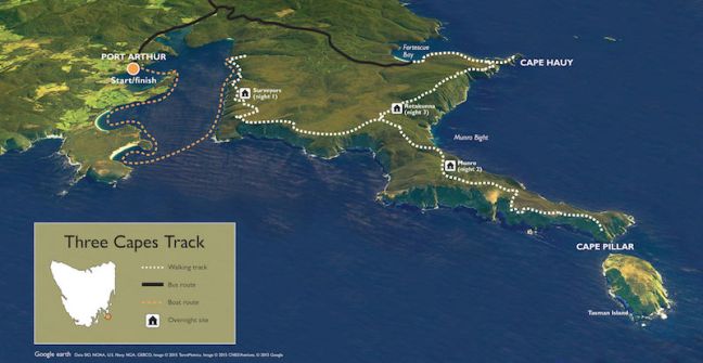
Overall, the Three Capes Track was a fabulous experience and it was a privilege to see such a beautiful and remote part of the world. We did have some discussions about the model for the hike — the section from the start to Munro Hut can now only be done as part of the Three Capes Track Experience, meaning independent hikers are excluded. However, they can still get to the tip of Cape Pillar, and Cape Hauy is a day hike from Fortescue Bay.
I’m not sure I’m on board with excluding independent hikers, but I do feel that these facilities make it possible for a greater breadth of people to participate. It certainly suited me at this stage of my life. I absolutely love trekking and adventure, but I do not absolutely love carrying a full pack. Moreover, sleeping on memory foam mattresses certainly beats my old and very thin thermorest. (Interestingly, the most popular demographics for the Three Capes Track are 1) over 50s, 2) women, 3) families.)
It was fabulous to explore another corner of my country, but there are still many many walks around the world I want to do. Some of them wilderness hikes, others through more civilised areas. On my radar at the moment are: the Mont Blanc circuit in Europe, the Appalachian Trail in the USA, the South West Coast path in the UK (plus many others), and the pilgrims way through southern Europe.
Which one shall I do next?

Fantastic! I’m dying to get to tassie!
LikeLiked by 1 person
Highly recommended 🙂
LikeLike
What a great outline of the trip. Only two highlights missed from my perspective. The hot shower on Day 2 at the end of the day and the fabulous Icey swim on Day 4 at the end to sooth all those saw muscles. I did enjoy the whiskey…. thanks .
LikeLike
Ah yes, the shower… I didn’t check it out, I admit. I think it involves filling and suspending a bucket with water heated by instant gas. I didn’t swim at Fortescue Bay, either, but many of our party did!
It was fabulous to meet you on the hike, Graeme!
LikeLike
That sounds fantastic! I totally want to do this some day.
LikeLiked by 1 person
This looks stunning. Carrying packs with food..er worries me though. Just found your blog so am going to explore further. Louise
LikeLiked by 1 person
Hi Louise – thanks for dropping in and following. 🙂
Ellen
LikeLike